
Participation Report - Computer Vision in Archaeology Training School
PhD Researcher in Archaeology of Climate Change, NOVA FCSH / CHAM
Introduction
From 14 to 18 September 2026, I participated in the Computer Vision in Archaeology Training School in Brno, Czech Republic. The five-day training school was organised within the trans-national access scheme of the ATRIUM Project, hosted by the Archaeological Information System of the Czech Republic (AIS CR) at the Institute of Archaeology of the Czech Academy of Sciences, and co-organised with the MAIA COST Action.
The training brought together 29 participants from different countries and disciplinary backgrounds, including archaeology, forensic science, art history and conservation. The programme combined theoretical sessions, practical exercises, demonstrations, discussions and presentations by participants. This combination provided an opportunity to explore how computer vision and machine-learning methods can be applied to archaeological and heritage research.
My participation was particularly relevant to my ongoing development as an interdisciplinary archaeologist. My doctoral research focuses on reconstructing palaeoenvironmental change and climatic variability in southwestern Portugal over the last 2,500 years through a multi-proxy geoarchaeological study of Miróbriga and the Poço de Barbaroxa de Baixo wetland.
Although I already had a general understanding of artificial intelligence and machine-learning concepts, my practical experience with computer vision and the application of these methods to archaeological material was more limited. The training therefore allowed me to develop this knowledge within a specifically archaeological context and to gain practical experience with computational approaches to visual data.
Introduction to computer vision
The first day introduced the main concepts and applications of computer vision, including different types of computer-vision tasks and the distinction between discriminative and generative models.
One of the first practical demonstrations involved CLIP and zero-shot classification, using photographs of archaeological artefacts. The exercise showed how a pre-trained vision-language model can be used to classify images without training a new model or creating a task-specific annotated dataset.
At the same time, the demonstration highlighted situations in which such an approach can produce misleading results. This was particularly useful because it introduced not only the possibilities offered by pre-trained models, but also the importance of understanding their limitations. It reinforced the need to critically assess computational outputs rather than treating model predictions as direct archaeological interpretations.
The session therefore established an important principle that continued throughout the training: computer-vision tools can support archaeological research, but their outputs need to be considered in relation to the data, the research question and the archaeological context.
Python and image processing
The training then moved towards practical programming for computer vision. We worked with Python, NumPy, Matplotlib and OpenCV, using archaeological imagery as the basis for the exercises.
One of the practical activities involved an image of the Venus of Dolní Věstonice. We worked through a basic computer-vision workflow to separate the figurine from its background and measure aspects of the resulting image.
For me, this exercise was useful in understanding how an archaeological image can be approached computationally. Rather than treating a photograph only as a visual representation of an object, the exercise demonstrated how its pixels can be manipulated, measured and analysed according to explicitly defined procedures.
The programming sessions also helped me become more comfortable working with Python notebooks, reading existing code, modifying it and identifying errors. This was particularly valuable because, although I had previous conceptual familiarity with AI and machine learning, my experience of independently developing image-processing workflows was more limited.
Working with archaeological and geological images
Following the training, I continued experimenting with image-processing workflows using archaeological and geological micro-images. I worked with .tif images and explored image resizing, standardisation and histogram matching.
These exercises helped me understand the importance of image preparation before applying computational analysis. Differences in image dimensions, resolution, lighting and pixel-value distributions can affect how images are subsequently compared or processed.
This was directly relevant to my own research experience because I work with visual material derived from both archaeological and geological contexts. The practical work provided an introduction to some of the steps required to transform a collection of heterogeneous images into a more consistent dataset suitable for further computational analysis.
It also helped me recognise that image preparation is not simply a preliminary technical step. Decisions about how images are resized, standardised or normalised can influence subsequent analyses and therefore need to be considered as part of the research workflow.
Archaeological datasets and annotation
Another major component of the training focused on archaeological datasets and image annotation. We were introduced to the AMČR-PAS artefact photographs and discussed what it means for an archaeological image to be annotated for machine-learning purposes.
The practical session included work with CVAT, together with an introduction to annotation formats such as COCO, YOLO and Pascal VOC. We also explored the role of automated and semi-automated approaches such as SAM 2 in the annotation process.
I found the discussion of the challenges associated with archaeological datasets particularly relevant. The instructors addressed issues including class imbalance, differences between archaeological vocabularies and incomplete or inconsistent metadata.
These issues demonstrate that preparing archaeological data for machine learning is not simply a technical process. Decisions about how archaeological objects are categorised, labelled and recorded directly affect the resulting dataset. Once these categories become machine-readable labels, the assumptions behind them can influence subsequent computational analysis.
From an archaeological perspective, this was an important aspect of the training because it highlighted the relationship between archaeological interpretation, data structures and computational classification.
Presentation of my research
As part of the training school, participants had the opportunity to present their own research projects. I presented my doctoral research:
“Reconstructing Palaeoenvironmental Change and Climatic Variability in Southwestern Portugal over the Last 2,500 Years: A Multi-Proxy Geoarchaeological Study of Miróbriga and Barbaroxa de Baixo Wetland”
I introduced the archaeological and environmental context of my research and discussed the integration of archaeological and geological evidence to investigate past environmental change and human-environment interactions.
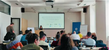
The other participant presentations demonstrated a wide range of applications of computational methods in archaeology, including hyperspectral imaging, geometric morphometrics, drone imagery, stone-carving analysis, 3D digitisation, petroglyphs, biomechanical analysis and artefact classification.
This exchange was particularly useful because it demonstrated the breadth of possible applications of AI and machine learning in archaeology. It also showed that the choice of computational approach needs to be closely connected to the research question, the nature of the material and the characteristics of the available dataset.
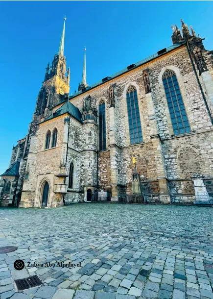
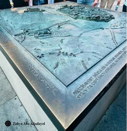
The programme also included a walking tour of Brno, which provided an opportunity to experience the city together and to continue conversations with other participants and instructors outside the formal sessions. This informal part of the programme was valuable for exchanging experiences across different countries and disciplinary backgrounds and contributed to the collaborative atmosphere of the training school.
Satellite imagery and archaeological prospection 

Another practical component of the training focused on satellite imagery and archaeological cropmarks.
Using Sentinel-2 imagery of the Bronze Age fortification at Cornești-Iarcuri in Romania, we explored spectral bands, NDVI, true- and false-colour composites and image-processing techniques for enhancing cropmarks.
The exercise then introduced a Random Forest classification workflow, including the use of manually selected points and hard negatives. We subsequently explored how the resulting classification could be converted into polygons suitable for use in GIS.
This session was particularly interesting in relation to my broader research interests because it demonstrated the potential of combining environmental information with archaeological interpretation. Vegetation responses visible in satellite imagery can provide indications of buried archaeological features, illustrating how environmental processes can also become sources of archaeological evidence.
Although satellite-based computer vision is not currently a central component of my doctoral methodology, the exercise provided a useful perspective on how remote sensing and computational analysis can contribute to archaeological research.
Developing a critical approach to AI in archaeology
One of the main outcomes of the training was a better understanding of the relationship between computational methods and archaeological interpretation.
The training demonstrated that AI and machine learning can assist archaeologists in processing, classifying and analysing large quantities of visual data. At the same time, the reliability and usefulness of these methods depend on the quality of the data, the way datasets are constructed, the categories used for annotation, the choice of model and the evaluation of its results.
This is particularly important in archaeology, where datasets are often heterogeneous and classification systems can vary according to research traditions, institutions and individual projects. Computational methods therefore need to be approached critically and in relation to the archaeological context in which the data were produced.
For me, this was an important complement to the technical aspects of the training. I came away with a better understanding not only of what computer vision can do, but also of the methodological questions that need to be considered when applying it to archaeological material.
Relevance to my research
The training has expanded my methodological toolkit and provided a foundation for further exploration of computational approaches within archaeological and geoarchaeological research.
My doctoral research currently relies on the integration of archaeological, sedimentological and other environmental evidence to investigate past environmental change. Computer vision is not the principal methodology of my PhD, but the training has made me more aware of the potential of visual data as another source of information and of the possibilities for processing such datasets computationally.
The practical work with image standardisation and image analysis was particularly relevant to my experience with archaeological and geological micro-images. More broadly, the training has provided me with a better understanding of how images can be transformed into structured datasets and subsequently analysed using machine-learning approaches.
It has also encouraged me to think about computational methods as complementary tools that can support, rather than replace, established archaeological and environmental approaches.
Conclusion
Participating in the Computer Vision in Archaeology Training School allowed me to develop my existing general understanding of AI and machine learning within a specifically archaeological context.
Over the course of the week, I gained practical experience with Python, image processing, archaeological image annotation, pre-trained models, machine-learning classification and satellite imagery. I also had the opportunity to present my doctoral research, exchange ideas with researchers working across different areas of archaeology and heritage, and explore Brno together with the other participants.
The training was particularly valuable in connecting technical skills with archaeological questions. It demonstrated both the potential of computational methods for working with large and complex visual datasets and the importance of critically considering how archaeological information is categorised, structured and interpreted within these systems.
The knowledge and practical skills gained during the school provide a useful foundation for my continued development in digital and computational archaeology. They also open possibilities for further exploring how computer vision and machine-learning approaches might complement my archaeological and geoarchaeological research in the future.